


|
|
|
|
|
|

 |
 |
||||||||||||||||
|
|
|||||||||||||||||
|
|
||||||

 |
|
An earlier access ramp was washed away |
The path has been taken even further west nearer the cliffs - themselves vulnerable to rock falls. The problems Ampersand have had in managing this beach since they began interfering with tempts Carlyon Bay Watch to say "I told you so".
The Carlyon Bay development was condemned as an example of bad practice by coastal management expert Dr Bob Earll in front of 300 delegates to a conference on Coastal Futures in January 2005. "Recent studies show that changing wave regimes in relation to climate change will mean that many Cornish beaches, upon which tourism in that region depends, are going to lose sand and become rocky platform. Building on a dynamic coastline such as that which exists in Cornwall is seriously problematic for all those concerned. Building there without knowing exactly how and by whom ongoing management is to be executed and funded is short-sighted in the extreme. There are many reasons why it is bad practice. With regard to the beaches at Carlyon Bay, there are so many parts of this project which are unacceptable that it is time to think again." (Dr Bob Earl, of Coastal Management for Sustainability).
Such expert opinions confirm what Carlyon Bay Watch has been saying all along. Because of its sheer size and nature, there should be a full Public Inquiry into the whole of the proposed development not just that already held into the sea wall and beach replenishment upon which it depends.
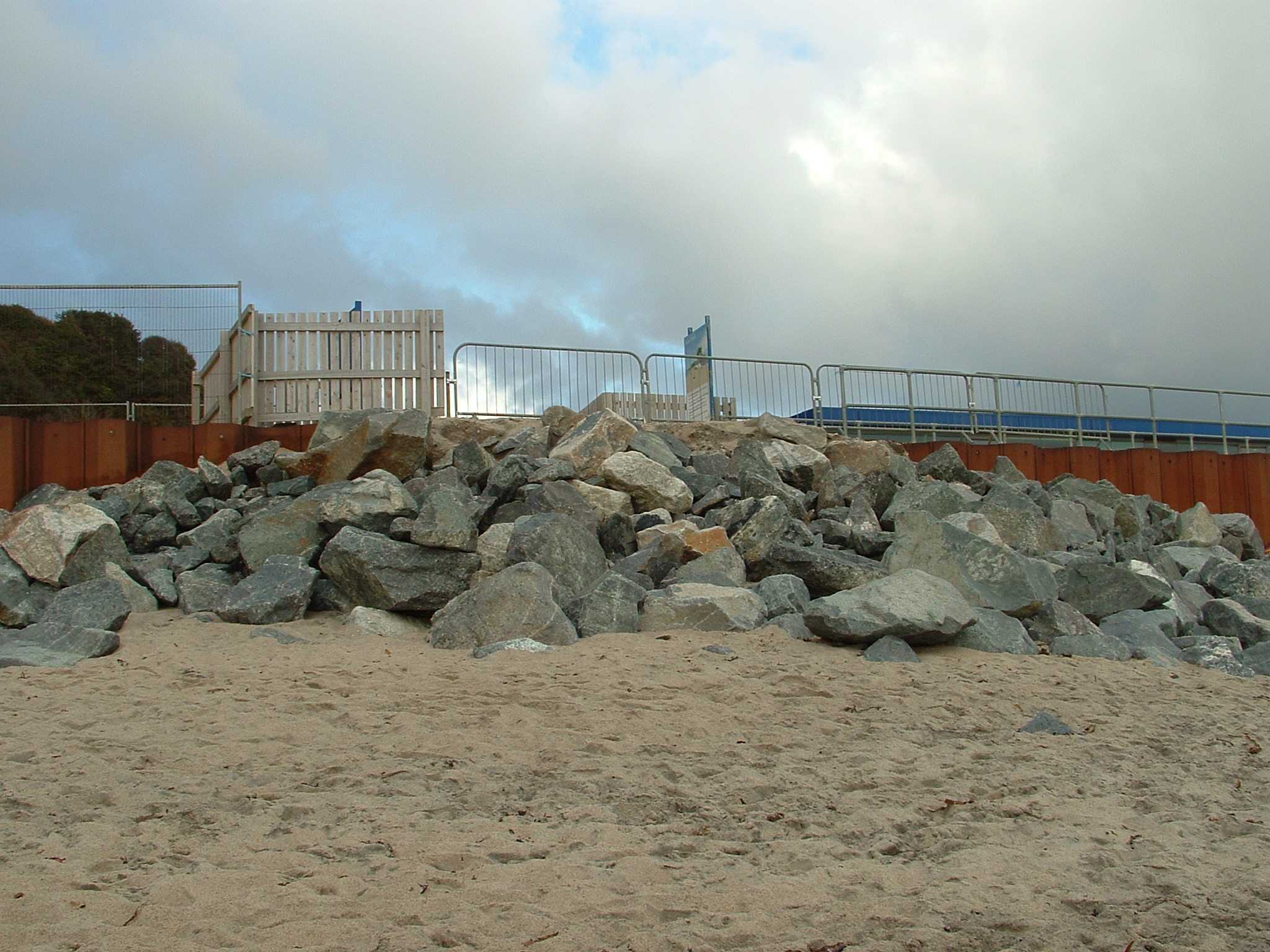
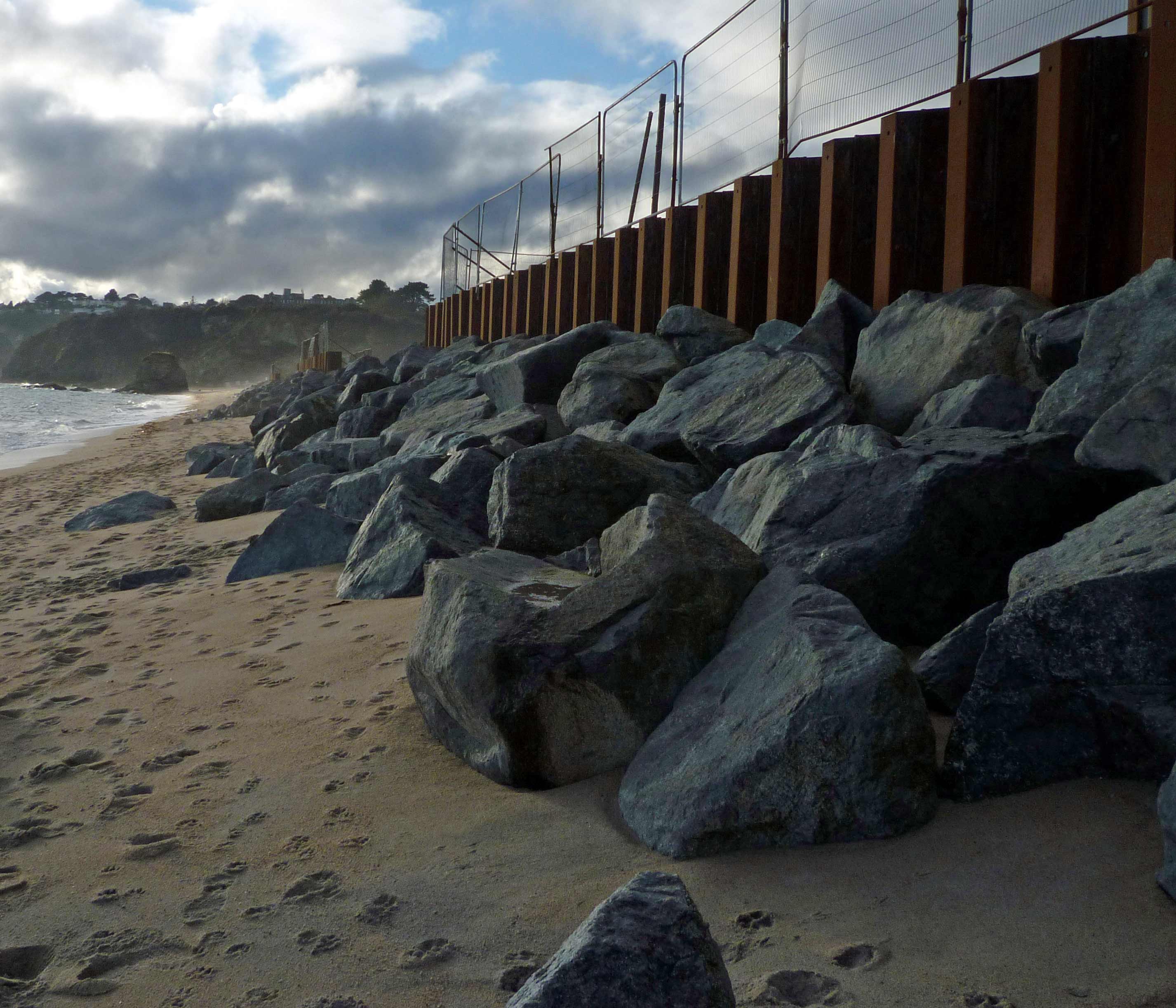
The developer's preferred sea defence scheme, currently under appeal after being refused by the Secretary of State, involves dumping thousands of tonnes of china clay waste (known as 'stent') on the beach to provide an extra layer of protection on top of rock armour and in front of the sea wall which projects into the tidal zone and would otherwise face the full force of the waves. This also, of course, provides the The Beach with its beach which otherwise, as a result of the placement of the shuttering and rock armour, is non-existent at high tide - not a problem in the past when previous buildings were erected away from the tidal zone and nearer the back of the beach. The fact that the beach is made up of gritty china clay waste, not soft sand, in itself provides a contrasting image to that conjured up by Ampersand in its publicity for The Beach when it refers to "golden shores".
During the intitial recharge operation 1,000 to 1,500 tonnes of stent would be delivered every day over a 12-month period. Jackson Civil Engineering in their Beach Recharge Operation Method Statement of 8 March 2005 said: "Delivery of beach recharge by land is an unusual operation in the UK and the proposed scheme in Carlyon Bay will be the largest such delivery/placement of such a recharge so far."
This amounts to nothing less than the perpetual dumping of industrial waste into the ocean. Ampersand maintains that the vast amount of recharge material put on to the beaches will stay put. They say: "Modelling indicates that there will not be any significant loss of material out of the Carlyon Bay system ... It is therefore unlikely that there will be any significant effect on the coastal sediment and hydrological processes in Carlyon Bay and the wider St Austell Bay." (Environmental Impact Assessment, Wardell Armstrong, January 2005).
EXPERT OPINION
(Read expert opinion from John Woods, former Chief Engineer Cornwall Flood Defence for the National Rivers Authority, who is totally opposed" to any residential development on the beach and from Dr Alan Francis, former Chief Geologist for English China Clay, who says there is potential for disaster in building on a "highly mobile" beach.)
In his evidence to the Public Inquiry, Dr Michael Fennessy, an oceanographer engaged by Carlyon Bay Watch to advise on aspects of the scheme, stated: "The situation that beach recharging is required at all should sound alarm bells to those concerned with coastal environmental management. The assertion by the planning application that it is required both during sea wall construction and at intervals thereafter is indicative of unknown results once the sea wall is built. ...Rock armouring is still in its infancy and as such many schemes must be seen as experimental. The design assertion that beach sediments will fill the pore spaces of the rock armouring and remain in situ must also be seen as an experiment. The designers have not quoted any other similar beach scheme where this has worked.
The Environmental Impact Assessment of February 2005 states that build up of beach sediment is expected at the east end of Carlyon Bay. Such prediction is already confirmed from field measurements in Carlyon Bay and the presence of angular china clay quartz sand on Par Beach (east of Carlyon Bay beaches), the latter being indicative of overflow from Carlyon Bay beaches. It is not known if these observations are the result of sand transport before the construction of the steel piling installed during 2004, but the potential is clearly evident; beach recharging will only exacerbate the situation. Longshore drift from bay to bay is the consequence of excess beach sediment becoming available, leading to the overflow condition. ... Adding more sediment beyond the proposed sea wall will only lead to accelerated losses to the east. Hence recharging will be an endless but fruitless solution to protecting the base of the proposed sea wall. ...Insufficient attention has been given to the unique properties of the sediment deposit in Carlyon Bay. The consequence of this is that the proposed sea wall is an entirely experimental structure."
Carlyon Bay Watch says this dumping of clay waste on the beach will have widespread repercussions away from Carlyon Bay and indeed the effects are already being felt following the dumping of the rocks and the erection of the steel shuttering. Local fishermen, whose experience should be better than 'modelling', testified to the changes brought about by the work on the beach.
LOCAL EXPERIENCE
 |
|
February 2010 - nearly high tide and the beach slopes steeply towards the tide line |
Richard Crowle was born in St Austell in 1945 and has lived in the area ever since. "I can say from experience that since I have been netting here these 30 years and more, the profile of the beach has changed considerably. Since the sea wall shuttering has been in place, the slope to the tide line has become very much steeper, and has very considerably shortened the beach. At high water, in places, there is now no beach. To my knowledge, much of this material has migrated eastward toward Par and Polkerris, because the tide, whether at flow or ebb, always runs eastward and my experience is that this has always been the case."
Raymond Endean has lived in the area for more than 80 years and is a third generation fisherman at Carlyon Bay. "I have witnessed the erosion of many millions of tons of sand from the beach over the years, with winds and tides taking it eastward. We've got the build up of sand at Spit Beach, all along that stretch of coastline to Par and beyond, resulting in the need for continuous dredging of the Par Harbour shipping channel, to prevent its silting up. Originally there was very little beach at Spit, and one had to climb down over thirty feet. It is now almost just a single step down because of the hundreds of thousands of tons of new sand." (Statutory Declaration of Raymond Endean of St Blazey, June 2005).
The scouring of sand from the Carlyon Bay beaches will not happen, according to the developers. But these local fishermen say it is already happening. This could in turn have a huge impact on other species in the bay such as eel grass. Carlyon Bay Watch's experts believe the increased sediment being washed out into the bay could result in 'smothering' of the eel grass beds - which are of National Importance and are a UK Biodiversity Action Plan habitat.
 |
|
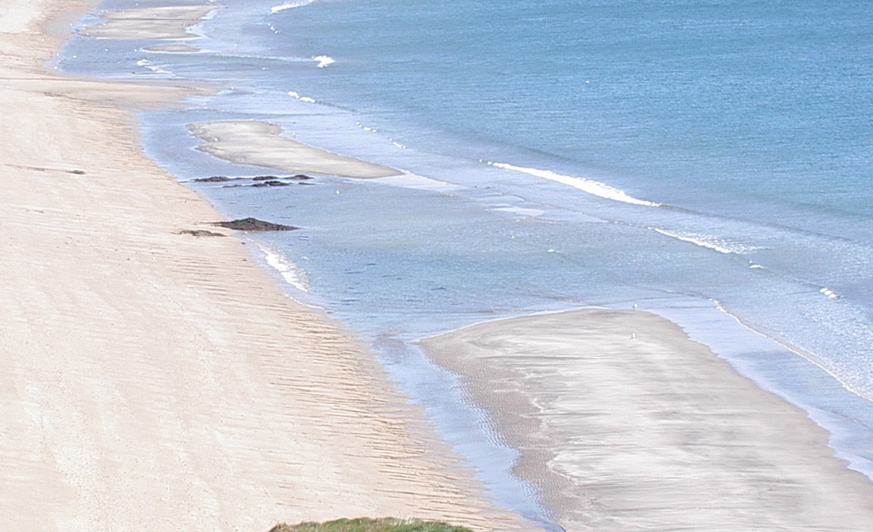
2005 - sand banks forming |
Rodney Sprague, also born in St Austell and fishing in the Bay for 40 years. "Since the construction work has been carried out on the beach, the structure and nature of it has changed considerably and these changes have made working the shoreline substantially harder. When the larger rocks were delivered and dropped from barges into the tidal zone, for the sea defences, a vast number of smaller rocks were left on the shoreline and in the shallower water. As a result I incurred further costs of having to mend my nets, which had been damaged by these abandoned rocks. Now some eight months later, due to the sand scoured from the shoreline and migrating into the tidal waters, many of these smaller rocks have become fully covered. Also as a result of wave scouring action, heavy sand banks have formed on the inshore bay line, again making it very difficult to navigate these waters with our small craft. The beach and its waters have now become dangerous. It is quite possible to get cut off at high tide. The beach is considerably steeper than it used to be, most noticeably at high tide, and there is now a substantial incoming tidal draw, which drags my nets forcefully towards Par. That never used to happen."
These accounts seem borne out by some experts in the field. "Erosion by wave action and the stream flow onto the beach, together with some eastwards drift towards Spit Beach, may therefore be gradually removing the artificially constructed beach...The sand level on the beach varies because of large scale movements from west to east and vice versa, depending on prevailing winds, particularly storms. Observation over many years indicates that....Because of the overall tendency of eastward drift, a small part of the area at the east end of Carlyon Bay Beach which was given planning permission for development about 15 years ago now lies permanently within the area affected by wave action during spring tides." ('Geoscience in the South West 10, 373 -376:' 'Field Excursion to the Area of St Austell Bay between Carlyon Bay and Par, 2nd January 2002'. Extracts of a Paper presented to the Proceedings of the Ussher Society by CM Bristow and HCL James).
For general enquiries email Carlyonbaywatch@aol.com