If you have any feedback on how we can make our new website better please do contact us. We would like to hear from you.
Carlyon Bay Watch has reproduced the following by the kind permission of Colin Bristow who describes the origins of the beaches at Carlyon Bay since Victorian times. Now retired, he was Chief Geologist at English China Clays, which was bought by Imerys in 1999. He was also Visiting Professor at Camborne School of Mines.
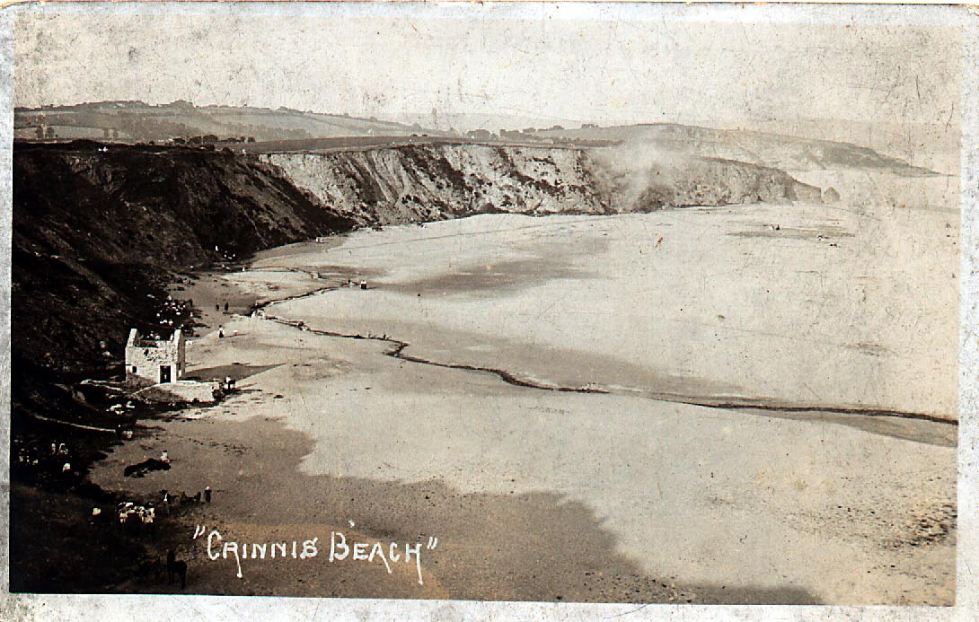
The beach at Carlyon Bay has been in the news in recent years because of the controversy over the proposed £200 million development there. However, the beach has not always been there and was formed over a relatively short 100 year time span from the middle of the 19th century to the middle of the 20th century. So, where did it come from?
EARLY WORKING FOR TIN
To explain this we must go back to ancient times when tin was obtained by washing the loose sandy deposits in the valleys in order to recover the heavy, tin-bearing mineral cassiterite. The stream, which flowed down from Carclaze, through Sandy Bottom to Holmbush and on towards Par Moor and Par, drained an area where there was much tin ore in the underlying rocks, so the loose sands and gravels in the valley bottom were a rich source of the mineral and were probably worked from Bronze Age times onwards. When Tesco was built, the kind of sandy gravels worked by the old-timers could be seen in the excavations for the bridge foundations.
In the course of tin streaming, a great deal of sand was thrown back into the stream, which carried it down towards its natural mouth in the vicinity of Par Harbour where it was deposited, or it was carried across the Bay by tidal currents to contribute to the formation of Par Sands. Before tin streaming began it is possible that high tides would have reached as high as where the sewage works is now, or possibly even as far as Wyvale Garden Centre.
As the tin streamers worked up the Sandy Valley towards Carclaze, they encountered a rich source of tin, which grew stronger as they progressed towards the top of the hill. Eventually they found that the source was a rich deposit of tin composed of many veins forming what is known as a 'stockwork'. The veins occurred in soft granite which had been altered to china clay. The hard vein material was pulverised in machines known as 'stamps', powered by waterwheels. The fine grains of tin could then be recovered from the unwanted mineral, which was mainly quartz. This was then dumped back into the headwaters of the stream, which then carried it, together with the coarse sand and clay from the decomposed granite between the veins, down towards Par.
The old tin pit at Carclaze was never large, probably around 5-10 acres at its maximum, which is tiny in comparison with present-day china clay pits. However, figures produced in the 19th century suggest that this small pit yielded tin worth over £100 million at the present tin price of £10,000 per ton. By the mid-19th century the pit was nearly exhausted and little tin was produced after this date.
Many famous people visited Carclaze open pit in the late 18th and early 19th centuries, because it was one of the few places in Cornwall where they could see how a tin mine was worked, without the need to go underground. One of the most interesting features was an underground canal, which connected the bottom of the pit with the processing area situated in the area which came to be known as 'Carclaze Yard', in the valley below. This canal has recently been rediscovered and is a strong candidate for the earliest underground canal in Britain - but that is another story!
THE PROBLEM OF SILTATION AT PAR HARBOUR
Meanwhile, the great mid-Cornwall entrepreneur Joseph Treffry was busy developing his copper mines and the granite quarries at Lanescot and Luxulyan. He needed a port in order to transport safely his quarry and mine products, so began to build the harbour at Par in the early 1830s. However, he soon realised that there would be a serious problem with the harbour silting up because of the quantity of sand being carried down towards Par by the Sandy Bottom stream. So he set his miners to work constructing a tunnel under where the golf course at Carlyon Bay is now, in order to divert the sediment-laden stream towards Shorthorn Bay, which is the central bay of the three which now form what we call Carlyon Bay. In about 1835 the tunnel was successfully completed and the siltation problem at Par Harbour became much more manageable. Up to this time the high tide lapped at the foot of the cliffs at Carlyon Bay and there was only a narrow beach exposed at low tide.
However the completion of the tunnel meant that the sediment coming through the tunnel began to form a beach in Shorthorn Bay. At first most of the sediment was fine mine tailings coming not only from Carclaze mine, but also Charlestown United mine (under Holmbush industrial estate) and, later in the 19th century, Wheal Eliza at Boscundle. The latter reached the peak of its output late in the 19th century, so would have been a major contributor. About 40 years ago it was possible to see this finer sandy material at the back of Shorthorn Bay, below the cliffs. The course of the stream from the tunnel exit across the beach to the sea changed many times, according to the prevailing wind direction.
CHINA CLAY SAND
To begin with, at Carclaze the china clay and sand from the pit was allowed to go to waste in the stream, but by the beginning of the 19th century it was realized that the china clay could be separated and sold profitably, so the rate of ground excavation rapidly increased. China clay sand is much coarser and more angular than the earlier fine mine tailings: strictly speaking it is, in part, a gravel. In about 1908 a new tunnel at a lower level was driven and two further clay works, known as 'Old Bal' and 'New Bal', north of the original tin pit, were brought into production. This further increased the rate of sand production, much of which found its way into the stream for onward transport to Carlyon Bay. A concrete block works on the site of where the St Austell Business Park is now took some of this sand, but most found its way to Carlyon Bay. Shorthorn Bay rapidly filled up and the sand spilled around to also fill up Polgaver Bay. Once the seaward edge of the sand accumulation had passed beyond the headland separating Shorthorn Bay from the bay where the wreck of the Cornwall Coliseum is now, the sand spilled around the headland and began to fill up this bay as well. Because the sand is composed of relatively angular and coarse grains, it forms a reasonable stable beach. However if the grains had been finer and more rounded it would have been more susceptible to being washed away in storms.
By the 1950s it was realised that disposing of the clay works sand into the stream was no longer acceptable, and the 1908 adit suffered a whole series of chokages and collapses, so Carclaze china clay works began to dispose of its sand onto a tip adjacent to the workings. Since the 1970s practically no sand has found its way into the stream.
So next time you are walking along the beach, look down at the sand and think that this mostly originated from the tin and china clay working at Carclaze and other areas. Most of the sand is the grey mineral quartz, but occasional black grains are usually tourmaline, a boron-containing mineral.


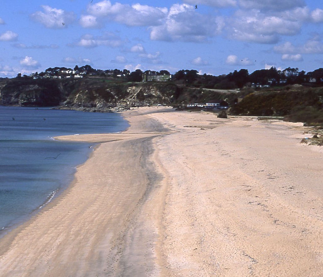 The beach at Carlyon Bay has been in the news in recent years because of the controversy over the proposed £200 million development there. However, the beach has not always been there and was formed over a relatively short 100 year time span from the middle of the 19th century to the middle of the 20th century. So, where did it come from?